


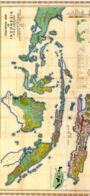
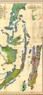
Maps of Indonesia
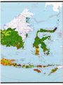
Indonesia counted 270.2 million people at the 2020 census and reached roughly 284 million by mid-2025. The map below shows how unevenly they settle. Java holds about 56 per cent of the total on some 7 per cent of the land, making it the most densely populated large island on Earth; DKI Jakarta is the densest province at nearly 15,900 people per square kilometre, while much of Papua and interior Kalimantan falls below 30.

For everyday navigation, residents use Google Maps and OpenStreetMap. The official mapping authority is now Badan Informasi Geospasial (BIG), which replaced Bakosurtanal in 2011; its free Ina-Geoportal at tanahair.indonesia.go.id serves the current Rupabumi Indonesia base maps.
Soil, Vegetation and Rainfall Maps
The government survey maps below date from the mid-twentieth century. Treat them as historical reference, not current data.

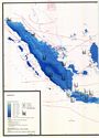
| Title: | Indonesia. Rata-Rata. Curah Hujan Setahun. B/04/01. [Annual Rainfall Everage] |
|---|---|
| Authors: | National Coordination Agency for Surveys and Mapping. |
| Year: | 1974 |
| Publishers: | National Coordination Agency for Surveys and Mapping. |
| Language: | In En |
| Coordinates: | Latitude N10°0 - S15°0 Longitude E90°0 - E144°0 |
| Scale: | 7,150,000 |
| Keywords: | Climate; Climatology |

| Title: | Indonesia. Liputan Foto Udara Berdasarkan Periode Pemotretan. Aereal Photography According to Date of Coverage. B/05/01. [Annual Rainfall Everage] |
|---|---|
| Authors: | National Coordination Agency for Surveys and Mapping. |
| Year: | 1978 |
| Publishers: | National Coordination Agency for Surveys and Mapping. |
| Language: | In En |
| Coordinates: | Latitude N10°0 - S15°0 Longitude E90°0 - E144°0 |
| Scale: | 7,150,000 |
| Keywords: | Climate; Climatology |

| Title: | Indonesia. Liputan Foto Udara Berdasarkan Sekala. Aereal Photography According to Scale. B/05/02. |
|---|---|
| Authors: | National Coordination Agency for Surveys and Mapping. |
| Year: | 1978 |
| Publishers: | National Coordination Agency for Surveys and Mapping. |
| Language: | In En |
| Coordinates: | Latitude N10°0 - S15°0 Longitude E90°0 - E144°0 |
| Scale: | 7,150,000 |
| Keywords: | Climate; Climatology |

| Title: | Indonesia. Liputan Peta Geologi. Sekala 1:20,000 - 1:150,000. B/05/04. [Geology Map Coverage. Scale 1:20,000 - 1:150,000.] |
|---|---|
| Authors: | National Coordination Agency for Surveys and Mapping. |
| Year: | 1976 |
| Publishers: | National Coordination Agency for Surveys and Mapping. |
| Language: | In En |
| Coordinates: | Latitude N10°0 - S15°0 Longitude E90°0 - E144°0 |
| Scale: | 7,150,000 |
| Keywords: | Geology |

| Title: | Indonesia. Liputan Peta Geologi. Sekala 1:200,000 - 1:600,000. B/05/05. [Geology Map Coverage. Scale 1:200,000 - 1:600,000] |
|---|---|
| Authors: | National Coordination Agency for Surveys and Mapping. |
| Year: | 1976 |
| Publishers: | National Coordination Agency for Surveys and Mapping. |
| Language: | In En |
| Coordinates: | Latitude N10°0 - S15°0 Longitude E90°0 - E144°0 |
| Scale: | 7,150,000 |
| Keywords: | Geology |

| Title: | Indonesia. Liputan Peta Geologi. Sekala 1:750,000 - 1:3,000,000. B/05/06. [Geology Map Coverage. Scale 1:750,000 - 1:3,000,000] |
|---|---|
| Authors: | National Coordination Agency for Surveys and Mapping. |
| Year: | 1976 |
| Publishers: | National Coordination Agency for Surveys and Mapping. |
| Language: | In En |
| Coordinates: | Latitude N10°0 - S15°0 Longitude E90°0 - E144°0 |
| Scale: | 7,150,000 |
| Keywords: | Geology |

| Title: | Indonesia. Liputan Peta Hutan Dari Interpretasi Foto Udara. B/05/07. [Forestry Map Coverage Based on Air Photo Interpretation] |
|---|---|
| Authors: | National Coordination Agency for Surveys and Mapping. |
| Year: | 1978 |
| Publishers: | National Coordination Agency for Surveys and Mapping. |
| Language: | In En |
| Coordinates: | Latitude N10°0 - S15°0 Longitude E90°0 - E144°0 |
| Scale: | 7,150,000 |
| Keywords: |

| Title: | Indonesia. Liputan Peta Tanah. B/05/08. [Soil Map Coverage] |
|---|---|
| Authors: | National Coordination Agency for Surveys and Mapping. |
| Year: | 1976 |
| Publishers: | National Coordination Agency for Surveys and Mapping. |
| Language: | In En |
| Coordinates: | Latitude N10°0 - S15°0 Longitude E90°0 - E144°0 |
| Scale: | 7,150,000 |
| Keywords: | Soil |

| Title: | Indonesia. Liputan Peta Tata Guna Tanah. B/05/09. [Land Use Map Coverage] |
|---|---|
| Authors: | National Coordination Agency for Surveys and Mapping. |
| Year: | 1976 |
| Publishers: | National Coordination Agency for Surveys and Mapping. |
| Language: | In En |
| Coordinates: | Latitude N10°0 - S15°0 Longitude E90°0 - E144°0 |
| Scale: | 7,150,000 |
| Keywords: | Land use |

| Title: | Indonesia. Liputan Peta Topografi. Sekala 1:25,000 - 1:63,000. B/05/10. [Topographic Map Coverage. Scale 1:25,000 - 1:63,000] |
|---|---|
| Authors: | National Coordination Agency for Surveys and Mapping. |
| Year: | 1978 |
| Publishers: | National Coordination Agency for Surveys and Mapping. |
| Language: | In En |
| Coordinates: | Latitude N10°0 - S15°0 Longitude E90°0 - E144°0 |
| Scale: | 7,150,000 |
| Keywords: | Topography |

| Title: | Indonesia. Liputan Peta Topografi. Sekala 1:100,000 - 1:200,000. B/05/11. [Topographic Map Coverage. Scale 1:100,000 - 1:200,000] |
|---|---|
| Authors: | National Coordination Agency for Surveys and Mapping. |
| Year: | 1978 |
| Publishers: | National Coordination Agency for Surveys and Mapping. |
| Language: | In En |
| Coordinates: | Latitude N10°0 - S15°0 Longitude E90°0 - E144°0 |
| Scale: | 7,150,000 |
| Keywords: | Topography |

| Title: | Indonesia. Liputan Peta Topografi. Sekala 1:250,000. B/05/12. [Topographic Map Coverage. Scale 1:250,000] |
|---|---|
| Authors: | National Coordination Agency for Surveys and Mapping. |
| Year: | 1978 |
| Publishers: | National Coordination Agency for Surveys and Mapping. |
| Language: | In En |
| Coordinates: | Latitude N10°0 - S15°0 Longitude E90°0 - E144°0 |
| Scale: | 7,150,000 |
| Keywords: | Topography |

| Title: | Indonesia. Liputan Peta Topografi. Sekala 1:300,000 - 1:1,000,000. B/05/13. [Topographic Map Coverage. Scale 1:300,000 - 1:1,000,000] |
|---|---|
| Authors: | National Coordination Agency for Surveys and Mapping. |
| Year: | 1978 |
| Publishers: | National Coordination Agency for Surveys and Mapping. |
| Language: | In En |
| Coordinates: | Latitude N10°0 - S15°0 Longitude E90°0 - E144°0 |
| Scale: | 7,150,000 |
| Keywords: | Topography |

| Title: | Indonesia. Liputan Slar. B/05/14. [Slar Coverage] |
|---|---|
| Authors: | National Coordination Agency for Surveys and Mapping. |
| Year: | 1976 |
| Publishers: | National Coordination Agency for Surveys and Mapping. |
| Language: | In En |
| Coordinates: | Latitude N10°0 - S15°0 Longitude E90°0 - E144°0 |
| Scale: | 7,150,000 |
| Keywords: |

| Title: | Indonesia. Prosentase Jumlah Buruh Industri Tahun 1971. B/06/02. [Industrial Labour Procentage in 1971] |
|---|---|
| Authors: | National Coordination Agency for Surveys and Mapping. |
| Year: | 1975 |
| Publishers: | National Coordination Agency for Surveys and Mapping. |
| Language: | In En |
| Coordinates: | Latitude N10°0 - S15°0 Longitude E90°0 - E144°0 |
| Scale: | 7,300,000 |
| Keywords: |

| Title: | Indonesia. Tanah. B/13/01. [Soil] |
|---|---|
| Authors: | National Coordination Agency for Surveys and Mapping. |
| Year: | 1975 |
| Publishers: | National Coordination Agency for Surveys and Mapping. |
| Language: | In En |
| Coordinates: | Latitude N10°0 - S15°0 Longitude E90°0 - E144°0 |
| Scale: | 7,300,000 |
| Keywords: | Soil |

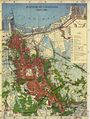
| Title: | Indonesia. Pembagian Administrasi Pemerintahan Negara Republik Indonesia. Ibukota Negara: Jakarta. |
|---|---|
| Year: | 1984 |
| Publishers: | P.T. Pembina. |
| Language: | In |
| Coordinates: | Latitude N10°0 - S15°0 Longitude E90°0 - E144°0 |
| Scale: | 5,300,000 |
| Keywords: | Topography |

| Year: | 1980 |
|---|---|
| Publishers: | FAO. AGLS. |
| Language: | En |
| Coordinates: | Latitude N22°0 - S24°0 Longitude E94°0 - E132°0 |
| Scale: | 5,000,000 |
| Keywords: |

| Title: | Agro-Climatic Map of Maluku and Irian Jaya. |
|---|---|
| Authors: | Oldeman, L.R.; Irsal, L.; Muladi; |
| Year: | 1980 |
| Publishers: | Central Research Institute for Agriculture, Bogor. |
| Language: | En |
| Coordinates: | Latitude N2°0 - S11°0 Longitude E115°0 - E141°0 |
| Scale: | 4,500,000 |
| Keywords: | Climate; Climatology |

| Title: | Agro-Climatic Map of Sumatra. |
|---|---|
| Authors: | Oldeman, L.R.; Darwis, S.N.; Las, I.; |
| Year: | 1978 |
| Publishers: | Central Research Institute for Agriculture, Bogor. |
| Language: | En |
| Coordinates: | Latitude N6°0 - S6°0 Longitude E95°0 - E108°0 |
| Scale: | 3,000,000 |
| Keywords: | Climate; Climatology |

| Title: | Agro-Climatic Map of Sumatra. "Is a double Example, Map ID 2000.2" |
|---|---|
| Authors: | Oldeman, L.R.; Darwis, S.N.; Las, I.; |
| Year: | 1978 |
| Publishers: | Central Research Institute for Agriculture, Bogor. |
| Language: | En |
| Coordinates: | Latitude N6°0 - S6°0 Longitude E95°0 - E108°0 |
| Scale: | 3,000,000 |
| Keywords: | Climate; Climatology |

| Title: | Agro-Climatic Map of Kalimantan. |
|---|---|
| Authors: | Oldeman, L.R.; Irsal, L.; Muladi; |
| Year: | 1980 |
| Publishers: | Central Research Institute for Agriculture, Bogor. |
| Language: | En |
| Coordinates: | Latitude N7°0 - S4°0 Longitude E108°0 - E120°0 |
| Scale: | 3,000,000 |
| Keywords: | Climate; Climatology |

| Title: | Agro-Climatic Map of Sulawesi. |
|---|---|
| Authors: | Oldeman, L.R.; Darmiyati, S.; |
| Year: | 1977 |
| Publishers: | Central Research Institute for Agriculture, Bogor. |
| Language: | En |
| Coordinates: | Latitude N2°0 - S6°0 Longitude E118°0 - E126°0 |
| Scale: | 2,500,000 |
| Keywords: | Climate; Climatology |

| Title: | Agro-Climatic Map of Aceh and North Sumatra. Agro-Climatic Map of Lampung and South Sumatra. |
|---|---|
| Authors: | Oldeman, L.R.;Darwis, S.N.; Las, I.; |
| Year: | 1977 |
| Publishers: | Central Research Institute for Agriculture, Bogor. |
| Language: | En |
| Coordinates: | Latitude N0°0 - S6°0 Longitude E95°0 - E105°0 |
| Scale: | 1,560,000 |
| Keywords: | Climate; Climatology |
| Title: | Vegetation Map of Indonesia. I |
|---|---|
| Authors: | Hannibal, L.W.; |
| Year: | 1950 |
| Publishers: | Kolff, Djakarta. |
| Language: | En |
| Coordinates: | Latitude N6°0 - S17°0 Longitude E94°0 - E140°30 |
| Scale: | 2,500,000 |
| Keywords: | Vegetation |
| Title: | Vegetation Map of Indonesia. II |
|---|---|
| Authors: | Hannibal, L.W.; |
| Year: | 1950 |
| Publishers: | Kolff, Djakarta. |
| Language: | En |
| Coordinates: | Latitude N6°0 - S17°0 Longitude E94°0 - E140°30 |
| Scale: | 2,500,000 |
| Keywords: | Vegetation |
| Title: | Republik Indonesia. Curah Hujan Tahunan. |
|---|---|
| Year: | 1981 |
| Publishers: | Direktorat Tata Guna Tanah Direktorat Jenderal Agraria. |
| Language: | En |
| Coordinates: | Latitude N6°0 - S12°0 Longitude E125°0 - E140°30 |
| Scale: | 2,500,000 |
| Keywords: | Climate; Climatology |
| Title: | Republik Indonesia. Curah Hujan Tahunan. |
|---|---|
| Year: | 1981 |
| Publishers: | Direktorat Tata Guna Tanah Direktorat Jenderal Agraria. |
| Language: | En |
| Coordinates: | Latitude N6°0 - S12°0 Longitude E110°0 - E126°0 |
| Scale: | 2,500,000 |
| Keywords: | Topography Climate; Climatology |
| Title: | Republik Indonesia. Curah Hujan Tahunan. |
|---|---|
| Year: | 1981 |
| Publishers: | Direktorat Tata Guna Tanah Direktorat Jenderal Agraria. |
| Language: | En |
| Coordinates: | Latitude N6°0 - S12°0 Longitude E95°0 - E110°0 |
| Scale: | 2,500,000 |
| Keywords: | Climate; Climatology |
| Title: | Republik Indonesia. Wilayah Administrasi. |
|---|---|
| Year: | 1981 |
| Publishers: | Direktorat Tata Guna Tanah Direktorat Jenderal Agraria. |
| Language: | En |
| Coordinates: | Latitude N6°0 - S12°0 Longitude E125°0 - E140°30 |
| Scale: | 2,500,000 |
| Keywords: | Topography |
| Title: | Republik Indonesia. Wilayah Administrasi. |
|---|---|
| Year: | 1981 |
| Publishers: | Direktorat Tata Guna Tanah Direktorat Jenderal Agraria. |
| Language: | En |
| Coordinates: | Latitude N6°0 - S12°0 Longitude E110°0 - E126°0 |
| Scale: | 2,500,000 |
| Keywords: | Topography |
| Title: | Republik Indonesia. Wilayah Administrasi. |
|---|---|
| Year: | 1981 |
| Publishers: | Direktorat Tata Guna Tanah Direktorat Jenderal Agraria. |
| Language: | En |
| Coordinates: | Latitude N6°0 - S12°0 Longitude E95°0 - E110°0 |
| Scale: | 2,500,000 |
| Keywords: | Topography |
| Title: | Republik Indonesia. Wilayah Administrasi. |
|---|---|
| Year: | 1981 |
| Publishers: | Direktorat Tata Guna Tanah Direktorat Jenderal Agraria. |
| Language: | En |
| Coordinates: | Latitude N6°0 - S12°0 Longitude E86°0 - E95°0 |
| Scale: | 2,500,000 |
| Keywords: | Topography |
| Title: | Republik Indonesia. Penggunaan Tanah. |
|---|---|
| Year: | 1981 |
| Publishers: | Direktorat Tata Guna Tanah Direktorat Jenderal Agraria. |
| Language: | En |
| Coordinates: | Latitude N6°0 - S12°0 Longitude E125°0 - E140°30 |
| Scale: | 2,500,000 |
| Keywords: | Topography |
| Title: | Republik Indonesia. Penggunaan Tanah. |
|---|---|
| Year: | 1981 |
| Publishers: | Direktorat Tata Guna Tanah Direktorat Jenderal Agraria. |
| Language: | En |
| Coordinates: | Latitude N6°0 - S12°0 Longitude E111°0 - E126°0 |
| Scale: | 2,500,000 |
| Keywords: | Topography |
| Title: | Republik Indonesia. Penggunaan Tanah. |
|---|---|
| Year: | 1981 |
| Publishers: | Direktorat Tata Guna Tanah Direktorat Jenderal Agraria. |
| Language: | En |
| Coordinates: | Latitude N6°0 - S12°0 Longitude E95°0 - E110°0 |
| Scale: | 2,500,000 |
| Keywords: | Topography |

| Title: | Land Development Units for Java, Bali and Kalimantan. Plate A2. |
|---|---|
| Authors: | Republic of Indonesia. Ministry of Agriculture. Directorate General of Agriculture. |
| Year: | 1973 |
| Publishers: | Soil Research Institute, Bogor. |
| Language: | En |
| Coordinates: | Latitude N1°0 - S9°0 Longitude E105°0 - E116°30 |
| Scale: | 2,500,000 |
| Keywords: | Topography, Land use |
| Title: | Land Development Units for Sulawesi and Nusa Tenggara. Plate A3. |
|---|---|
| Authors: | Republic of Indonesia. Ministry of Agriculture. Directorate General of Agriculture. |
| Year: | 1973 |
| Publishers: | Soil Research Institute, Bogor. |
| Language: | En |
| Coordinates: | Latitude N2°0 - N9°0 Longitude E117°0 - E125°30 |
| Scale: | 2,500,000 |
| Keywords: | Topography, Land use |

| Title: | Land Suitability Groups for Wetland Rice for Sumatra. Plate B1. |
|---|---|
| Authors: | Republic of Indonesia. Ministry of Agriculture. Directorate General of Agriculture. |
| Year: | 1973 |
| Publishers: | Soil Research Institute, Bogor. |
| Language: | En |
| Coordinates: | Latitude N5°50 - S6°0 Longitude E95°0 - E108°30 |
| Scale: | 2,500,000 |
| Keywords: | Land use |

| Title: | Land Suitability Groups for Wetland Rice for Java, Bali and Kalimantan. Plate B2. |
|---|---|
| Authors: | Republic of Indonesia. Ministry of Agriculture. Directorate General of Agriculture. |
| Year: | 1973 |
| Publishers: | Soil Research Institute, Bogor. |
| Language: | En |
| Coordinates: | Latitude N1°0 - S9°0 Longitude E105°0 - E116°30 |
| Scale: | 2,500,000 |
| Keywords: | Land use |
| Title: | Land Suitability Groups for Wetland Rice for Sulawesi and Nusa Tenggara. Plate B3. |
|---|---|
| Authors: | Republic of Indonesia. Ministry of Agriculture. Directorate General of Agriculture. |
| Year: | 1973 |
| Publishers: | Soil Research Institute, Bogor. |
| Language: | En |
| Coordinates: | Latitude N2°0 - N9°0 Longitude E117°0 - E125°30 |
| Scale: | 2,500,000 |
| Keywords: | Land use |

| Title: | Land Capability Classification for Upland Crop Cultivation for Sumatra. Plate C1. |
|---|---|
| Authors: | Republic of Indonesia. Ministry of Agriculture. Directorate General of Agriculture. |
| Year: | 1973 |
| Publishers: | Soil Research Institute, Bogor. |
| Language: | En |
| Coordinates: | Latitude N5°50 - S6°0 Longitude E95°0 - E108°30 |
| Scale: | 2,500,000 |
| Keywords: | Land use, Soil |

| Title: | Land Capability Classification for Upland Crop Cultivation for Java, Bali and Kalimantan. Plate C2. |
|---|---|
| Authors: | Republic of Indonesia. Ministry of Agriculture. Directorate General of Agriculture. |
| Year: | 1973 |
| Publishers: | Soil Research Institute, Bogor. |
| Language: | En |
| Coordinates: | Latitude N1°0 - S9°0 Longitude E105°0 - E116°30 |
| Scale: | 2,500,000 |
| Keywords: | Land use, Soil |

| Title: | Soil Associations of Java, Madura and Bali. GS 1724-C. |
|---|---|
| Year: | 1959 |
| Publishers: | Soil Research Institute, Bogor. |
| Language: | En |
| Coordinates: | Latitude S5°50 - S9°10 Longitude E105°0 - E116°0 |
| Scale: | 2,000,000 |
| Keywords: | Soil |

| Title: | Soil Associations of Java, Madura and Bali. GS 1724-C. |
|---|---|
| Year: | 1959 |
| Publishers: | Soil Research Institute, Bogor. |
| Language: | En |
| Coordinates: | Latitude S5°50 - S9°10 Longitude E105°0 - E116°0 |
| Scale: | 1,000,000 |
| Keywords: | Soil |

| Title: | Soil Associations of Java, Madura and Bali. GS 1724-C. |
|---|---|
| Year: | 1959 |
| Publishers: | Soil Research Institute, Bogor. |
| Language: | En |
| Coordinates: | Latitude S5°50 - S9°10 Longitude E105°0 - E116°0 |
| Scale: | 1,000,000 |
| Keywords: | Soil |

| Title: | Exploratory Soil Map of Java and Madura. GS 1581. |
|---|---|
| Language: | En |
| Coordinates: | Latitude S5°30 - S9°0 Longitude E105°0 - E115°0 |
| Scale: | 1,000,000 |
| Keywords: | Soil |

| Title: | Exploratory Soil Map of Java and Madura. |
|---|---|
| Year: | 1960 |
| Publishers: | Directorate Topographical Service, Indonesian Army, Djakarta. |
| Language: | En |
| Coordinates: | Latitude S5°30 - S9°0 Longitude E105°0 - E115°0 |
| Scale: | 1,000,000 |
| Keywords: | Soil |

| Title: | Land Use Map of Java and Madura. |
|---|---|
| Year: | 1963 |
| Publishers: | Land and Water Development Division. |
| Language: | En |
| Coordinates: | Latitude S5°30 - S9°0 Longitude E105°0 - E115°0 |
| Scale: | 1,000,000 |
| Keywords: | Land use |

| Title: | Overzichtskaart van het Eiland Sumatra. Overzicht van de Politieke Indeeling van Sumatra. |
|---|---|
| Year: | 1996 |
| Publishers: | Herdruk Topografische Dienst Nederland en Koninklijk Instituut voor de Tropen. |
| Language: | NL |
| Coordinates: | Latitude N5°50 - S6°5 Longitude E95°0 - E106°5 |
| Scale: | 1,650,000 |
| Keywords: | Physical geography; Social geography; Topography |

| Title: | Geologische Overzichtskaart van den Nederlandsch Oost-Indischen Archipel (Vogelkop). Blad XIII. |
|---|---|
| Authors: | Zwierzycki Dr, J.; |
| Year: | 1930 |
| Publishers: | Herdruk Topografische Dienst Nederland en Koninklijk Instituut voor de Tropen. |
| Language: | NL |
| Coordinates: | Latitude N1°0 - S5°0 Longitude E131°0 - E137°0 |
| Scale: | 1,000,000 |
| Keywords: | Geology; Topography |

| Title: | Carte Internationale du Tapis Végétal et des Conditions Écologiques. Sumatra Sud. [International Map of the Vegetation and the Environmental Conditions. Southern Sumatra]. Sheet no. 1. |
|---|---|
| Authors: | Blasco, F.; Laumonier, Y.; Purnajaya,; |
| Year: | 1986 |
| Publishers: | SEAMEO-BIOTROP, Bogor, Indonesia. |
| Language: | In En |
| Coordinates: | Latitude S1°20 - S6°0 Longitude E100°30 - E106°20 |
| Scale: | 1,000,000 |
| Keywords: | Climate; Climatology; Geology; Soil; Topography |

| Title: | Carte Internationale du Tapis Végétal et des Conditions Écologiques. Sumatra Centre. [International Map of the Vegetation and the Environmental Conditions. Central Sumatra]. Sheet no. 2. |
|---|---|
| Authors: | Blasco, F.; Laumonier, Y.; Purnajaya,; |
| Year: | 1986 |
| Publishers: | SEAMEO-BIOTROP, Bogor, Indonesia. |
| Language: | In En |
| Coordinates: | Latitude N2°10 - S2°10 Longitude E98°50 - E104°30 |
| Scale: | 1,000,000 |
| Keywords: | Climate; Climatology; Geology; Soil; Topography |

| Title: | Carte Internationale du Tapis Végétal et des Conditions Écologiques. Sumatra Nord. [International Map of the Vegetation and the Environmental Conditions. Northern Sumatra]. Sheet no. 3. |
|---|---|
| Authors: | Blasco, F.; Laumonier, Y.; Purnajaya,; |
| Year: | 1986 |
| Publishers: | SEAMEO-BIOTROP, Bogor, Indonesia. |
| Language: | In En |
| Coordinates: | Latitude N5°55 - N1°10 Longitude E95°0 - E101°0 |
| Scale: | 1,000,000 |
| Keywords: | Climate; Climatology; Geology; Soil; Topography |
| Title: | Zuid Sumatra. Routekaart en Bemonsteringsnet van de Bodemkundige Opname. |
|---|---|
| Authors: | Idenburg, A.G.A.; |
| Publishers: | G.W. van der Wiel, Arnhem. |
| Language: | Nl |
| Coordinates: | Latitude S1°20 - S6°0 Longitude E100°30 - E106°20 |
| Scale: | 500,000 |
| Keywords: | Soil |
| Title: | Grondkaart van Zuid Sumatra. |
|---|---|
| Authors: | Idenburg, A.G.A.; Szemian, J.M.K.; |
| Publishers: | G.W. van der Wiel, Arnhem. |
| Language: | Nl |
| Coordinates: | Latitude S1°20 - S6°0 Longitude E100°30 - E106°20 |
| Scale: | 500,000 |
| Keywords: | Soil |

| Title: | Peta Tanah Tinjau. propinski Djawa Barat. Lembaga Penelitian Tanah. [Soil Map West Java] |
|---|---|
| Year: | 1966 |
| Language: | In |
| Coordinates: | Latitude S6°25 - S9°0 Longitude E105°50 - E108°50 |
| Scale: | 250,000 |
| Keywords: | Soil |

| Title: | Peta Tanah Tinjau. Propinski Jawa Timur. Lembaga Penelitian Tanah. |
|---|---|
| Year: | 1966 |
| Language: | In |
| Coordinates: | Latitude S6°30 - S8°0 Longitude E111°0 - E114°30 |
| Scale: | 250,000 |
| Keywords: | Soil |

| Title: | Central Sumatra. Indonesia. Soils. Map 1. |
|---|---|
| Authors: | Hansell, J.R.F.; |
| Year: | 1981 |
| Publishers: | Land Resources Development Centre, Overseas Development Administration, Tolworth, Subition, Surrey, England, KT6 7DY. |
| Language: | En |
| Coordinates: | Latitude S1°15 - S2°40 Longitude E101°30 - E102°55 |
| Scale: | 250,000 |
| Keywords: | Soil |

| Title: | Central Sumatra. Indonesia. Land Suitability. Map 2. |
|---|---|
| Authors: | Hansell, J.R.F.; |
| Year: | 1981 |
| Publishers: | Land Resources Development Centre, Overseas Development Administration, Tolworth, Subition, Surrey, England, KT6 7DY. |
| Language: | En |
| Coordinates: | Latitude S1°15 - S2°40 Longitude E101°30 - E102°55 |
| Scale: | 250,000 |
| Keywords: | Land use, Soil Soil |
| Title: | Kuamang Kuning, Central Sumatra. Indonesia. Physical Plan. Map 3. |
|---|---|
| Authors: | Hansell, J.R.F.; |
| Year: | 1981 |
| Publishers: | Land Resources Development Centre, Overseas Development Administration, Tolworth, Subition, Surrey, England, KT6 7DY. |
| Language: | En |
| Coordinates: | Latitude S1°36 - S1°40 Longitude E102°16 - E102°19 |
| Scale: | 10,000 |
| Keywords: |
| Title: | Cimanuk Watershed (West Java). Isohyetal Map (mm). Map 1. |
|---|---|
| Year: | 1977 |
| Publishers: | Trust Fund of the Government of Indonesia. FAO, Bogor. |
| Language: | En |
| Coordinates: | Latitude S6°10 - S7°30 Longitude E107°35 - E108°35 |
| Scale: | 400,000 |
| Keywords: | Climate; Climatology |
| Title: | Cimanuk Watershed (West Java). Driest Month (P% of the Driest Month). Map 2. |
|---|---|
| Year: | 1977 |
| Publishers: | Trust Fund of the Government of Indonesia. FAO, Bogor. |
| Language: | En |
| Coordinates: | Latitude S6°10 - S7°30 Longitude E107°35 - E108°35 |
| Scale: | 400,000 |
| Keywords: | Climate; Climatology |
| Title: | Cimanuk Watershed (West Java). Rainest Month. Map 3. |
|---|---|
| Year: | 1977 |
| Publishers: | Trust Fund of the Government of Indonesia. FAO, Bogor. |
| Language: | En |
| Coordinates: | Latitude S6°10 - S7°30 Longitude E107°35 - E108°35 |
| Scale: | 400,000 |
| Keywords: | Climate; Climatology |
| Title: | Cimanuk Watershed (West Java). Rainfall equence Types. Map 4. |
|---|---|
| Year: | 1977 |
| Publishers: | Trust Fund of the Government of Indonesia. FAO, Bogor. |
| Language: | En |
| Coordinates: | Latitude S6°10 - S7°30 Longitude E107°35 - E108°35 |
| Scale: | 400,000 |
| Keywords: | Climate; Climatology |

| Title: | Bodemkundige Kaart van Java en Madoera. Blad 76, Jogjakarta. |
|---|---|
| Year: | 1930 |
| Publishers: | Reproductiebedrijf Topografische Dienst, Batavia. |
| Language: | Nl |
| Coordinates: | Latitude S7°40 - S8°0 Longitude E3°20 - E3°40 |
| Scale: | 100,000 |
| Keywords: | Soil |

| Title: | Bodemkundige Kaart van Java en Madoera. Blad 77, Grogol. |
|---|---|
| Year: | 1931 |
| Publishers: | Reproductiebedrijf Topografische Dienst, Batavia. |
| Language: | Nl |
| Coordinates: | Latitude S8°0 - S8°20 Longitude E3°20 - E3°40 |
| Scale: | 100,000 |
| Keywords: | Soil |

| Title: | Bodemkundige Kaart van Java en Madoera. Blad 83, Semanoe. |
|---|---|
| Year: | 1931 |
| Publishers: | Reproductiebedrijf Topografische Dienst, Batavia. |
| Language: | Nl |
| Coordinates: | Latitude S8°0 - S8°20 Longitude E3°40 - E4°0 |
| Scale: | 100,000 |
| Keywords: | Soil |

| Title: | Alai Hilir and Kuamang Kuning. Sumatra Soils. Map 1. |
|---|---|
| Authors: | Riley, D.P.; Harding, P.E.; |
| Year: | 1979 |
| Publishers: | Land Resources Development Centre, Overseas Development Administration, Tolworth, Subition, Surrey, England, KT6 7DY. |
| Language: | En |
| Coordinates: | Latitude S1°17 - S1°48 Longitude E102°5 - E102°49 |
| Scale: | 100,000 |
| Keywords: | Soil |

| Title: | Hitam Ulu and Kubang Ujo. Sumatra Soils. Map 2. |
|---|---|
| Authors: | Riley, D.P.; Harding, P.E.; |
| Year: | 1979 |
| Publishers: | Land Resources Development Centre, Overseas Development Administration, Tolworth, Subition, Surrey, England, KT6 7DY. |
| Language: | En |
| Coordinates: | Latitude S1°48 - S2°18 Longitude E102°15 - E103°4 |
| Scale: | 100,000 |
| Keywords: | Soil |

| Title: | Singkut. Sumatra Soils. Map 3. |
|---|---|
| Authors: | Riley, D.P.; Harding, P.E.; |
| Year: | 1979 |
| Publishers: | Land Resources Development Centre, Overseas Development Administration, Tolworth, Subition, Surrey, England, KT6 7DY. |
| Language: | En |
| Coordinates: | Latitude S2°18 - S2°48 Longitude E102°15 - E10°59 |
| Scale: | 100,000 |
| Keywords: | Soil |
| Title: | Photomozaic No. 6. (Middle Cimanuk Basin). Sheet 1. |
|---|---|
| Year: | 1976 |
| Publishers: | Trust Fund of the Government of Indonesia. FAO, Bogor. |
| Language: | En |
| Coordinates: | Latitude S6°10 - S7°30 Longitude E107°35 - E108°35 |
| Scale: | 50,000 |
| Keywords: | Land use |
| Title: | Stereotriplets. Sheet 2. |
|---|---|
| Year: | 1976 |
| Publishers: | Trust Fund of the Government of Indonesia. FAO, Bogor. |
| Language: | En |
| Coordinates: | Latitude S6°10 - S7°30 Longitude E107°35 - E108°35 |
| Scale: | 50,000 |
| Keywords: | Land use |

| Title: | Peta Tanah Semi Detil. Daerah Istimewa Yogyakarta. 5019-1. [Semi-Detailed Soil Map. Yogyakarta Province.] |
|---|---|
| Authors: | Muslihat, L.; Soleh, Ngadimin, H.; |
| Year: | 1995 |
| Publishers: | Centre for Soil and Agroclimate Research. |
| Language: | In En |
| Coordinates: | Latitude S7°40 - S7°50 Longitude E110°15 - E110°30 |
| Scale: | 50,000 |
| Keywords: | Soil |

| Title: | Peta Tanah Semi Detil. Daerah Nusadua-Padangbai. Propinsi Bali. 1707-33. [Semi-Detailed Soil Map. Nusadua-Padangbai Area. Bali Province.] |
|---|---|
| Authors: | Siswanto, A.B.; Margomulyono, E.; Bhekti, H.; |
| Year: | 1995 |
| Publishers: | Centre for Soil and Agroclimate Research. |
| Language: | In En |
| Coordinates: | Latitude S30°0 - S45°0 Longitude E0°0 - E15°0 |
| Scale: | 50,000 |
| Keywords: | Soil |
| Title: | Plattegrond van Batavia. |
|---|---|
| Year: | 1995 |
| Language: | Nl |
| Coordinates: | Latitude S6°5 - S6°15 Longitude E106°45 - E106°55 |
| Scale: | 20,000 |
| Keywords: | Topography |
| Title: | Plattegrond van Batavia. – BACKSIDE LEGEND |
|---|---|
| Year: | 1995 |
| Language: | Nl |
| Coordinates: | Latitude S6°5 - S6°15 Longitude E106°45 - E106°55 |
| Scale: | 20,000 |
| Keywords: | Topography |

| Title: | Primary Forest. Mentaya-East. (Central-Kalimantan). |
|---|---|
| Authors: | Sieffermann, G.; Levang, P.; |
| Year: | 1979 |
| Publishers: | Departemen Tenaga Dan Transmigrasi. Republik Indonesia. |
| Language: | En |
| Coordinates: | Latitude S1°50 - S2°0 Longitude E112°10 - E112°20 |
| Scale: | 50,000 |
| Keywords: | Land use |

| Title: | Soil Map. Mentaya-East. (Central-Kalimantan). |
|---|---|
| Authors: | Sieffermann, G.; Levang, P.; |
| Year: | 1982 |
| Publishers: | Departemen Tenaga Dan Transmigrasi. Republik Indonesia. |
| Language: | En |
| Coordinates: | Latitude S1°50 - S2°0 Longitude E112°10 - E112°20 |
| Scale: | 50,000 |
| Keywords: | Soil |

| Title: | Shifting Cultivation and Primary Forest. Sheet 1. Tumbang Sepayang. Mentaya-East.(Central-Kalimantan). |
|---|---|
| Authors: | Sieffermann, G.; Levang, P.; |
| Year: | 1981 |
| Publishers: | Departemen Tenaga Dan Transmigrasi. Republik Indonesia. |
| Language: | En |
| Coordinates: | Latitude S1°50 - S2°0 Longitude E112°10 - E112°20 |
| Scale: | 21,000 |
| Keywords: | Land use |

| Title: | Physiographic and Hydrographic Map. Sheet 2. Tumbang Sepayang. Mentaya-East.(Central-Kalimantan). |
|---|---|
| Authors: | Sieffermann, G.; Levang, P.; |
| Year: | 1981 |
| Publishers: | Departemen Tenaga Dan Transmigrasi. Republik Indonesia. |
| Language: | En |
| Coordinates: | Latitude S1°50 - S2°0 Longitude E112°10 - E112°20 |
| Scale: | 21,000 |
| Keywords: | Hydrology; Physical geography |

| Title: | Physiographic and Hydrographic Map. Sheet 2. Tumbang Sangai. Mentaya-East.(Central-Kalimantan). |
|---|---|
| Authors: | Sieffermann, G.; Levang, P.; |
| Year: | 1982 |
| Publishers: | Departemen Tenaga Dan Transmigrasi. Republik Indonesia. |
| Language: | En |
| Coordinates: | Latitude S1°50 - S2°0 Longitude E112°10 - E112°20 |
| Scale: | 21,000 |
| Keywords: | Hydrology; Physical geography |

| Title: | Physiographic and Hydrographic Map. Sheet 3. Tanjung Juriangau. Mentaya-East.(Central-Kalimantan). |
|---|---|
| Authors: | Sieffermann, G.; Levang, P.; |
| Year: | 1981 |
| Publishers: | Departemen Tenaga Dan Transmigrasi. Republik Indonesia. |
| Language: | En |
| Coordinates: | Latitude S1°50 - S2°0 Longitude E112°10 - E112°20 |
| Scale: | 21,000 |
| Keywords: | Hydrology; Physical geography |
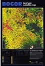
| Title: | Bogor. Land Use Satellite Map. |
|---|---|
| Year: | 1987 |
| Publishers: | Government of Indonesia. Ministry of Public Works. Directorate General for Human Settlement. Bogor Water Supply Project Detailed Design. |
| Language: | En |
| Coordinates: | Latitude S6°30 - S6°55 Longitude E106°44 - E107°1 |
| Scale: | 50,000 |
| Keywords: | Land use; Topography |
Citation: Selvaradjou, S-K., L. Montanarella, O. Spaargaren and D. Dent (2005). European Digital Archive of Soil Maps (EuDASM) – Soil Maps of Asia DVD-ROM version. EUR 21823 EN. Office of the Official Publications of the European Communities, Luxembourg.
Have comments or corrections? Please email editor [at] livinginindonesia.info.